
DeZwerver.nl
Wandkaart Frankrijk, België en Nederland, 60 x 77 cm | National Geographic
Wandkaart Frankrijk, België en Nederland, 60 x 77 cm | National Geographic
Verzendkosten € 5,95
31,95

Gevonden bij 1 winkel vanaf
€ 31,95
(minder betalen?)
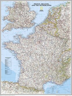
Our classic wall map of France, Belgium, and the Netherlands shows political boundaries, major highways and roads, cities and towns, and a wealth of other incredibly accurate geographic detail.
Map is printed on premium quality paper stock, laminated, rolled, and packaged in a clear plastic sleeve.