
DeZwerver.nl
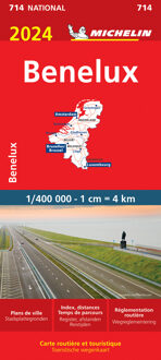
Wegenkaart - landkaart 714 Benelux 2024 | Michelin
Wegenkaart - landkaart 714 Benelux 2024 | Michelin
Verzendkosten € 2,95
11,95

Gevonden bij 3 winkels vanaf
€ 11,95
(minder betalen?)
Zoals je van Michelin mag verwachten is deze kaart zeer overzichtelijk en heeft een duidelijk helder kaartbeeld. De kaart geeft uitgebreid toeristische informatie weer. Met stadsplattegrond van de hoofdstad.
Grote kracht van de Michelin kaarten is het uitstekende kaartbeeld. Ze maken gebruik van goede kleuren waardoor het zeer leesbaar is. Daarnaast staat er veel informatie op, ook toeristische details en bezienswaardigheden. Erg handig zijn de zogenaamde groene wegen: met een groene lijn geeft Michelin aan welke routes het mooist zijn om te rijden.
Daarnaast wordt een beperkt aantal campings weergegeven, helaas niet allemaal. Meestal betreft het de zgn. camping municipale ofwel de gemeentecampings.
Benelux at 1:400,000 from Michelin, with information on driving regulations in each country, a distance and journey time table, plus enlargements showing in greater detail road access to Amsterdam, Brussels and Luxembourg City. Coverage extends east to include the Ruhr and the Eifel in Germany.
Roads network includes local roads and is graded according to the number of lanes. Junctions show full or partial interchanges. Steep gradients, level crossings and restricted entry sections are marked; scenic routes are highlighted. Railway lines and ferry routes are included.
Relief shading is used to indicate the topography, with colouring for forested areas. National parks are also marked. Small symbols indicate various landmarks or places of interest including campsites and youth hostels, but the map is not primarily designed to highlight tourist sights.
The map also indicates locations with street plans in Michelin’s Red Guides to Hotels and Restaurants in Belgium and Luxembourg and in the Netherlands. Latitude and longitude lines are drawn at 20’ intervals. Multilingual map legend includes English. The index, arranged by country, is on the reverse of the map.
Also provided is basic information on each country’s driving regulations, plus a table showing driving distances and journey times between 26 main cities
Amsterdam, Bruxelles, Eindhover, Liège, Luxembourg, Maastricht, Rotterdam