
DeZwerver.nl
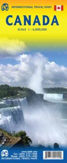
Wegenkaart - landkaart Canada | ITMB
Wegenkaart - landkaart Canada | ITMB
Verzendkosten € 2,95
14,95

Gevonden bij 1 winkel vanaf
€ 14,95
(minder betalen?)
Een degelijke kaart met aanduidingen van o.a. nationale parken, vliegveld, benzinepomp, dirt-roads en kleine plattegrond van hoofdstad.
Well, it’s about time, eh?!? ITMB, after only thirty years on the go, finally gets around to publishing a map of Canada. When we first started mapping, there was a pressing need for good maps of Central and South America, then of Africa, then etc etc and we never found time to concentrate on our own country until fairly recently. This map was prepared by Natural Resources Canada and is, as a result, as accurate a map as one could hope to have. We are very proud of it, and very pleased to be able to use such top-rate cartography. The map covers all of the land mass of Canada, from its southernmost point to the top of Ellesmere Island and from the Atlantic coast to the Pacific. It’s an excellent map, but I’m going to give one proviso. Canada is the second-largest country on the face of the planet and there is no way that a single-sided sheet can portray a country this vast comprehensively. That said, it’s a great map. CMO doesn’t make a bad map. We published it because we feel that it fills a big niche. It shows major roads, rail lines, lots of urban areas (not just the big ones), major tourist sites and parks, world heritage sites, and it even includes St. Pierre et Miquelon, the French possession south of Newfoundland. It is printed on paper.
Legend Includes:
Roads by classification, Trans-Canada highway, national parks, points of interest, world heritage sites, and more.