
DeZwerver.nl
Wegenkaart - landkaart Western Australia state map | Hema Maps
Wegenkaart - landkaart Western Australia state map | Hema Maps
Verzendkosten € 2,95
17,95

Gevonden bij 1 winkel vanaf
€ 17,95
(minder betalen?)
Goede, overzichtelijke, leesbare kaart van de hele provincie. Nationale Parken zijn er goed op te vinden en de afstanden worden weergegeven. Op de achterkant nog deelkaartjes van enkele steden en NP s.
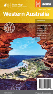
A state map of Western Australia at a scale of 1:2,500,000. Marked on the map are national parks, points of interest, 24-hour fuel as well as camping and rest areas.
On the reverse side are national park maps of Leeuwin-Naturaliste, Cape Range, Nambung, Francois Peron, Purnululu, Walpole-Nornalup and Karijini.
Also included are CBD and throughroad maps of Perth. There is a full index included, as well as all national park information.
Points of interest
24-hour fuel
National parks
Camping areas
Rest areas
Fully indexed