
DeZwerver.nl
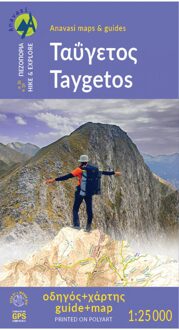
Wandelkaart 8.1 Mt. Taygetos - Peloponnesos | Anavasi
Wandelkaart 8.1 Mt. Taygetos - Peloponnesos | Anavasi
Verzendkosten € 2,95
25,95

Gevonden bij 1 winkel vanaf
€ 25,95
(minder betalen?)
Uitstekende topografische kaarten van een deel van Griekenland: zonder meer hele goede kaarten voor wandeltochten in een onbekend stuk Griekenland! Ze zijn gedrukt op scheurvast en watervast papier op een schaal van 1:25.000 met een UTM grid voor GPS gebruikers.
Op de meeste kaarten is geven de hoogtelijnen een interval van 20m. aan. Met schaduwkleuren, punten met hoogtemeters, bronnen, riviertjes en landgebruik geven ze de topografie van het land goed weer.
Lokale voetpaden, herbergen en berghutten zijn duidelijk weergegeven. De wegen zijn in gradaties getekend: verhard en onverhard, groot en klein, met afstanden en benzinepompen.
Toeristische bezienswaardigheden als kloosters, grotten, kerken etc staan ingetekend. Achterop de kaart worden suggesties gegeven voor wandelroutes met wandeltijd in uren.
This is not just a hiking map, this is a hiking guide AND 1: 25 000 map.
Taygetos extends as 70 km of magnificent massif anchoring the southern tip of Greece. From a dense network of challenging trails, we selected routes favored since antiquity by devotees of sky-gods or their successor, the Prophet Elijah. Paths wrapped in glorious nature. Trails that exploit favourable folds in the terrain, or follow the rugged gorges that were until recently the only gateway to the mountain.
Each route has its topo map and altitude profile, plus duration, distance, degree of difficulty, vegetation, sights, and links to other trails. Photographs and a route description enrich the picture.
Find out how the ancient Spartans carved out wagon roads to conquer Greece’s most dramatic mountain 2500 years ago, by Professor Yanis Pikoulas.
In the new hiking guide with a map 1:25 000 of Taygetos,18 routes are described, divided into areas: Laconian, Messinian, Center and North side of Taygetos, as well as ancient routes crossing the mountain in Antiquity.
Among the 18 routes there are all levels of difficulty: GREEN = EASY | BLUE = INTERMEDITATE | RED = DEMANDING | BLACK = VERY DIFFICULT. The difficulty depends on elevation range, length and type of terrain
See the routes here:
1. Manganari - Refuge - summit Profitis Ilias 2407m
2. Refuge - summit Profitis Ilias 2407m – Agios Dimitrios – Pentavli - Refuge
3. Refuge – peak Chalasmeno 2204m
4. Pikoulianika – peak Koufovouni 1850m
5. Anavryti – Refuge
6. Parori - Faneromeni monastery - Metamorfosi Sotiros - Parori
7. Mystras - Taygeti
8. Mystras - Castle North Gate - Mystras ΤAYGETOS (Messenian side)
9. Agios Dimitrios - Mousgia - peak Chalasmeno 2204m
10. Vyros Gorge (Agios Dimitrios - Exochori)
11. Ridomo Gorge (Voreio to Pigadia Stone bridge)
12. Velanidia monastery - Lagou hann
Crossing of Mount Taygetos crestline
3. Pentadaktylos
NORTH ΤAYGETOS(with the help of EOS SPARTIS and Nikos Laganas)
14. Longastra - Trypi - Pikoulianika - Mystras
15. Marble-bridge – Bridge – Kastori springs - Vrysiotiko - Perivolia springs - Agios Loukas - Ring road of Kastori - Agios Mamas springs
16. Myli Gorge (Georgitsi - Kastori)
17. Georgitsi - Agios Panteleimon 18. Kastorio - Xerovouna (of 2 sections of it)
18α. Latta - Lousina / 18β. Lousina - Xerovouna