
DeZwerver.nl
Wandelkaart 15 Canmore Up-Close | Gem Trek Maps
Wandelkaart 15 Canmore Up-Close | Gem Trek Maps
Verzendkosten € 2,95
13,95

Gevonden bij 1 winkel vanaf
€ 13,95
(minder betalen?)
Waterproof and tear-resistant hiking and recreation map for the town of Canmore and surrounds in the Canadian Rockies.
Designed for both locals and visitors, Gem Trek’s 1:35,000 Canmore Up-Close Map is a detailed relief-shaded topographic map of Canmore and the Bow Valley area. This edition has been updated to show all new subdivisions and recent changes to the trail network. On the back of the Canmore Up-Close Map are descriptions of recommended sights and detailed descriptions of the best and most scenic hiking and biking trails, including the highlights of each trail, as well as distance, elevation gain and directions to the trailhead. Also on the back of the map is an inset map of downtown Canmore and colour photos.
Map specs
Edition: 2nd
Scale: 1:35,000
Folded size: 4.5 x 9.5 inches
Flat size: 18 x 24 inches
Paper: Waterproof and tear-resistant
Map coverage
The Canmore Up-Close Map focuses on the town of Canmore in the Canadian Rockies. The map boundary extends along the Bow Valley from Banff National Park in the west to Dead Man’s Flats in the east and from the Fairholme Range in the north to the Three Sisters in the south.
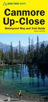
Canmore is blessed with a network of trails that can be accessed from the town. This map covers them all, including along the Bow River, to Quarry Lake, Canmore Nordic Centre, Grassi Lakes (shown on the map cover), Ha Ling, the Windy Valley, Mount Lady Macdonald, and the Highline and Cloudline mountain biking trails.
Map features
The Canmore Up-Close Map features:
- waterproof and tear-resistant paper
- contour lines at 25-metre (80-foot) intervals
- relief shading to better show the topography
- full colour on both sides
- hiking trails with trail names and trail distances marked
- mountain biking and equestrian trails with trail names and distances marked
- hydrology including rivers, rapids and waterfalls
- mountain names and all available mountain elevations
- all campgrounds with a handy chart showing campground details
- points of interest and attractions as well as day use areas and highway viewpoints
About Gem Trek Maps: Gem Trek was founded in the early 1990s with the publication of maps to the Kananaskis Country region of the Canadian Rockies. Today, with over 1,000,000 maps sold, we remain a vibrant, proudly independent map publisher specializing in producing Canadian Rockies maps. Our cartographers, writers, and photographers are all locals, who love the outdoors and enjoy the challenge of producing the very best maps possible.