
DeZwerver.nl
Wegenkaart - landkaart Australia South & Northern Territory | ITMB
Wegenkaart - landkaart Australia South & Northern Territory | ITMB
Verzendkosten € 2,95
14,95

Gevonden bij 1 winkel vanaf
€ 14,95
(minder betalen?)
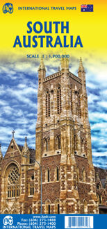
Australia was one of the first countries ITMB published, back in the 1980s, albeit a licensed version. Our own original artwork was completed in the mid-1990s, but until recently, we have not focused on sectional maps of the country based on individual states. In 2019, we published Brisbane and Queensland, and Sydney and New South Wales. Now, we are issuing the ‘middle’ states of South Australia and Northern Territory to provide better coverage of these important parts of Australia at a better scale than a country map could provide. South Australia can be thought of as having two parts; the fertile farming economy surrounding Adelaide in the south and the much more arid northern portion. The road network in the south tends to be well developed, with paved roads going more or less east-west to NSW and WA. Northerly roads tend to be gravel or dirt, such as the Birdville Track, and the north-westerly roads tend to pass through land ceded to aboriginals and require permits. Northern Territory occupies the second side. It is state-like, if not legally a state, and occupies a huge area. The north-south highway from Darwin through Alice Springs to SA is the main transportation route of the territory, with one highway going to NSW and a partly-paved one to QLD. ITMB can supply maps of Adelaide and Darwin by other publishers.
Legend Includes:
Roads by classification, Rivers and Lakes, National Park, Airports, Points of Interests, Mining, Highways, Main Roads, Zoos, Fishing, , and much more...