
DeZwerver.nl
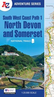
Wandelatlas 1 Adventure Atlas South West Coast Path North Devon & Somerset | A-Z Map Company
Wandelatlas 1 Adventure Atlas South West Coast Path North Devon & Somerset | A-Z Map Company
Verzendkosten € 2,95
17,95

Gevonden bij 1 winkel vanaf
€ 17,95
(minder betalen?)
AZ heeft de meest gedetailleerde wandelkaarten van delen van het South West Coast Path gebundeld in een atlasje. Daardoor is het heel handig qua formaat. De kaarten zelf zijn perfect voor het wandelen. Schaal 1:25.000
Plan your next adventure along the North Devon & Somerset section of the South West Coast Path with trusted mapping from A-Z The perfect companion for those who love the great outdoors, the A-Z Adventure Series features 1:25000 Ordnance Survey mapping in a convenient book, complete with index. The South West Coast Path is a National Trail along the Somerset, Devon, Cornwall and Dorset coasts. This stunning walk from Minehead, Somerset covers 630 miles to South Haven Point in Poole Harbour, passing through two World Heritage Sites (the Jurassic Coast and the Cornwall and West Devon Mining Landscape), Exmoor National Park, Land's End and many areas of outstanding natural beauty.
This guide to the North Devon and Somerset section features 36 pages of continuous Ordnance Survey mapping and covers the South West Coast Path from Minehead to Bude. This atlas includes a route planner providing the distances between places and the amenities available, featuring: Information CentresVisitor CentresHotels/B&BsYouth HostelsCampsites (seasonal opening)Public HousesShopsRestaurantsCafes (seasonal opening)Petrol stations
A series of five A-Z Adventure Atlases together cover the South West Coast Path:
SW Coast Path North Devon and Somerset
SW Coast Path North Cornwall
SW Coast Path South Cornwall
SW Coast Path South Devon
SW Coast Path Dorset
This A-Z Adventure Atlas of the SW Coast Path North Devon and Somerset features 36 pages of continuous OS mapping covering the route from Minehead to Bude. The trail is easy to follow, highlighted in yellow to stand out from other footpaths, with mileage markers to gauge distances when planning your own sections of the walk to enjoy.
The book includes a route planner showing distances between places and indicates available amenities, including:
Information Centres
Visitor Centres
Hotels/B&Bs
Youth Hostels
Campsites (seasonal opening)
Public Houses
Shops
Restaurants
Cafes (seasonal opening)
Petrol stations
Also featured is a selection of QR codes to access useful websites with your smartphone.
Unlike original OS Explorer sheets, this A-Z Adventure Atlas includes a comprehensive index to towns, villages, hamlets and locations, natural features, nature reserves, car parks and youth hostels. Each index entry has a simple page reference and a six figure National Grid reference.
OS 1:25000 is Ordnance Survey's most detailed leisure mapping, showing public rights of way, open access land, national parks, tourist information, car parks, public houses and camping and caravan sites.
With a book size of 240mm x 134mm Adventure Atlases are the same size as a folded OS map, ideal for map pockets etc.