
DeZwerver.nl
Wegenatlas Traveller's Atlas Southern Africa - Zuidelijk Afrika | A3-Formaat | Ringband | Tracks4Africa
Wegenatlas Traveller's Atlas Southern Africa - Zuidelijk Afrika | A3-Formaat | Ringband | Tracks4Africa
Verzendkosten € 5,95
79,95

Gevonden bij 1 winkel vanaf
€ 79,95
(minder betalen?)
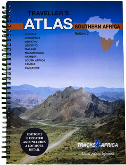
Deze atlas omvat tien landen in zuidelijk Afrika en is speciaal gericht op reizigers die zelf rijden. De betrokken landen zijn: Angola, Botswana, Lesotho, Malawi, Mozambique, Namibië, Zuid-Afrika, Swaziland, Zambia en Zimbabwe.
De Atlas bevat 223 kaartpagina's met hetzelfde vertrouwde kaartdetail waarvoor Tracks4Africa bekend is.
De wegenatlas is afgedrukt in A3 formaat, weegt 2750g, heeft een stevige omslag, spiraal gebonden en de pagina's zijn afgedrukt op dik papier.
Bigger coverage than ever before:
1:4m maps for Southern and Eastern Africa – ideal for macro planning.
1:1m maps for Southern Africa, covering the following countries: Angola, Botswana, eSwatini, Lesotho, Malawi, Mozambique, Namibia,
South Africa, Zambia and Zimbabwe.
1:500k maps for South Africa, Malawi, most part of Zambia and the area around Moremi/Chobe in Botswana.
Road coverage:
This Atlas is designed for overland travel and compiled from the same data used on our famous GPS maps. Use it for trip planning or on the road as a companion for your GPS navigation system.
The detailed road network covers 518 350km.
All major and secondary routes feature distances and travel times (1m and 500k maps only).
Each country page features a table with the times and distances between major towns.
Vital information needed for planning an extended self-drive trip:
Per country information includes legal requirements for your vehicle, road conditions, traffic rules, signals used by locals as well as general tips such as fuel availability.
Comprehensive information of what you need to transit borders.
Featuring 127 border posts with opening times.
Valuable information while on the road:
This Atlas is jam-packed with as much detail as possible on protected areas, major and minor attractions, places to stay and activities. You can also see which services like fuel, bank/ATM, shopping, restaurant, hospital, police or auto repair are available in each town.
The Atlas features 223 map pages with the same trusted map detail for which Tracks4Africa is renowned.
Map features include:
Map scales include 1:4000 000, 1:1000 000; 1:500 000
518 350km of off-road tracks and major roads.
Distance and travel time between towns.
Essential facilities available in towns.
Camping and lodging.
Tourist attractions.
All border crossings, with opening times.
All international airports, with IATA/ICAO codes.
Protected areas.
The first section of the Atlas includes valuable travel information about each of the ten countries. The information about border crossings and top tourist attractions will help you to be well-prepared for your trip and the sections on driving conditions will assist you while on the road.