
DeZwerver.nl
Wegenkaart - landkaart Iconic Map Top End and Gulf | Hema Maps
Wegenkaart - landkaart Iconic Map Top End and Gulf | Hema Maps
Verzendkosten € 2,95
17,95

Gevonden bij 1 winkel vanaf
€ 17,95
(minder betalen?)
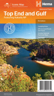
This regional waterproof map of the Top End and Gulf is ideal for discovering the northern parts of Australia's NT by 4WD. It includes a main map of the Darwin region, Judbarra / Gregory National Park, Nhulunbuy, Keep River National Park and Boodjamulla (Lawn Hill) National Park.
There is additional tourist information for Arnhem Land, the Roper River trek, Darwin region, Douglas-Daly district, Nature’s Way, Victoria Highway, Katherine Region and the Stuart Highway Region.
PRODUCT FEATURES
GPS surveyed roads and tracks
Fuel stops
Self-drive 4WD tracks
Camping areas
Historic sites
Detailed National Park inset maps
WHAT'S NEW IN THIS EDITION:
New edition, new layout
New cartographic map specifications
All inset maps are now provided in a better scale