
DeZwerver.nl
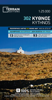
Wandelkaart 302 Kythnos | Terrain maps
Wandelkaart 302 Kythnos | Terrain maps
Verzendkosten € 2,95
11,95

Gevonden bij 1 winkel vanaf
€ 11,95
(minder betalen?)
Erg goede wandelkaart van Kythnos, weerbestendig en volledig. Bezienswaardigheden, campings en andere praktische zaken staan op de kaart aangegeven. GPS toepasbaar.
This is the best map of Kythnos because:
It is waterproof and rip-proof. You can fold and unfold it a thousand times, fold it in irregular ways, dunk it in the sea or leave it out in the rain. This map is indestructible!
It is the first GIS map of the island, meaning that this is the first time Kythnos is mapped with a topographic precision in proportion to the map scale.
It is remarkably detailed, at a scale twice as large as the competition’s, which makes everything crystal clear!
It is the first map depicting the island’s trails with total precision, their length measured in kilometers so you can estimate the duration of your hike, and detailed descriptions of Kythnos’ 13 best trails on the back.
It is the first time the island’s entire coastline is mapped. Cartography was done with TERRAIN’s specially equipped and staffed cartographic vessel. This means that you can locate all beaches of the island, down to the tiniest cove! In fact, the special features of every single beach are recorded: whether it is sandy or pebbled, whether it features natural tree shade, water, a beach bar or organized water sports, whether the seabed in front of the beach is sandy or rocky (so that you will know where to anchor).
It indicates the boundaries of NATURA 2000 areas so that you will know which parts of the island are of special environmental interest and beauty – thus you can enjoy traveling through them, but also take care to protect them.
It features the most complete road network. It is beyond comparison with any other map on the market! The dirt road heading to the lighthouse at Kefalos cape, the dirt road south of Hora headed to Dryopida, and a multitude of detours and junctions appear on a map of the island for the first time. Moreover, it features a detailed city map with all points of interest marked.