
DeZwerver.nl
Wandelkaart 249 Wrangell and St.Elias National Park | National Geographic
Wandelkaart 249 Wrangell and St.Elias National Park | National Geographic
Verzendkosten € 2,95
17,95

Gevonden bij 1 winkel vanaf
€ 17,95
(minder betalen?)
Prachtige geplastificeerde kaart van het bekende nationaal park. Met alle recreatieve voorzieningen als campsites, maar ook met topografische details en wandelroutes ed. Door uitgekiend kleurgebruik zeer prettig in gebruik. Scheur en watervast!
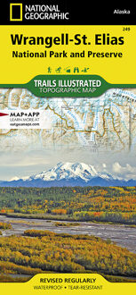
This two-sided map (325.000) covers Wrangell - St. Elias National Park in its entirety, along with Tetlin National Wildlife Refuge, portions of Chugach National Forest, the Bering Glacier, Robinson Mountains, Chugach Mountains, Wrangell Mountains, and Kayak Island State Marine Park. Towns include Katalla, Mt. Hazelet, Cape Yakataga, Kennicott, McCarthy, Slana, and Glennallen. The map features two detailed insets (85.000). The first includes Yakutat Bay, Disenchantment Bay, Russel Fjord, Nunatak Fjord, the Malaspina Glacier. The second detailed inset shows the Kennicott and McCarthy areas, along with the Bonanza Ridge, Fireweed Mountain, and the Nizina River.